
Kaokoland & Epupa Falls
Namibia’s remote northwest: gravel and rock, Himba settlements, desert elephants in the dry rivers — and at the end of it all, the Kunene and the Epupa Falls.
Home Destinations Namibia Kaokoland & Epupa
In short
The Kaokoland is the northwest of the Kunene Region and one of the most remote parts of southern Africa: few tracks, hardly any fuel stations, no phone signal for days. From Opuwo, the main town, it is about 180 kilometres of gravel to the Epupa Falls on the Kunene border river. Drive here only in a 4x4, with experience or a guide — and take Van Zyl’s Pass in one direction only.
Fact file
Kaokoland at a glance
- Location
- Northwest of the Kunene Region, bordered by the Kunene River and Angola to the north
- Main town
- Opuwo, capital of the Kunene Region and the last major supply stop
- People
- OvaHimba and Herero, many of them livestock herders
- Getting there
- Windhoek – Opuwo about 720 km of tar, Opuwo – Epupa about 180 km of gravel
- Best time
- May – September
- Water at the falls
- Most from February – May, least around October


Epupa Falls
Where the Kunene foams
On the Kunene border river, the water tumbles over about 1.5 kilometres of cascades into a gorge; the largest drop is 37 metres. “Epupa” is Herero for “foam” — after the spray that hangs above the palms on the banks.
- 01
Getting there
From Opuwo about 180 km of gravel on the C43. Tarring began in November 2025, and construction will take years.
- 02
When there is most water
After the rainy season in the Angolan highlands, roughly February to May. Around October the Kunene carries the least water.
- 03
Do not swim
Crocodiles live in the Kunene — no swimming in the open river, however tempting the water is in the heat.
- 04
No dam at the falls
A dam at the falls was dropped after opposition from the Himba. A power station is planned 48 km downstream at Baynes, which would not flood the falls — it has not been built yet.
On the road
Passes, valleys and dry rivers
The Kaokoland has hardly any towns, but routes that 4x4 drivers talk about for years.
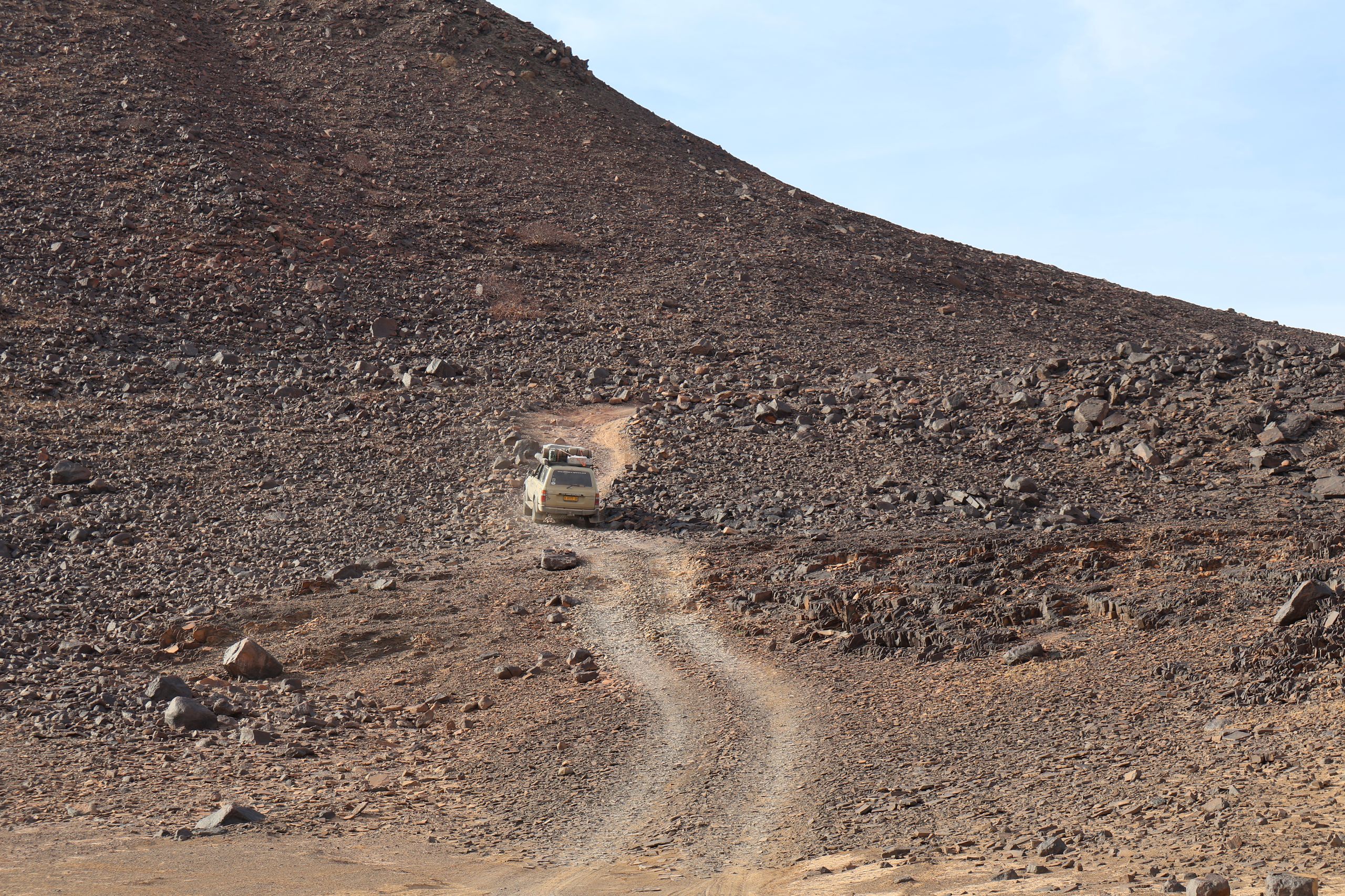
East to west only
Van Zyl’s Pass
About 15 km of rock and scree from Otjitanda down into the Marienfluss. It is driven downhill only, in low range and ideally in convoy — up to six hours for the stretch.
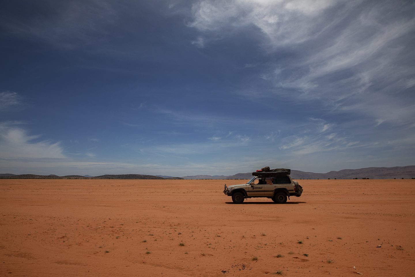
On the Kunene
Marienfluss & Hartmann’s Valley
The Marienfluss is a wide grassy valley between the Otjihipa and Hartmann mountains that runs down to the Kunene, dotted with fairy circles. West of it lies Hartmann’s Valley: soft sand, for experienced drivers only.
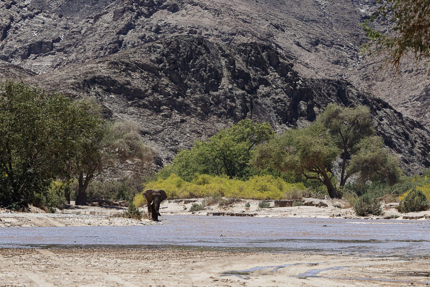
In the dry rivers
Desert elephants
They live in five groups along the Hoarusib, Hoanib, Uniab, Huab and Ugab dry rivers and get by on very little water. Conservation groups estimate only about 150 remain.


Good to know
Respect and safety
The Kaokoland forgives little. These four points come before every trip.
- 01
Ask first, then take photos
The Himba live here; they are not a roadside motif. Always ask before photographing people — ideally with someone who speaks the language.
- 02
Avoid dry rivers in storms
After rain further upstream, dry rivers can flood within a short time, the German Foreign Office warns. Never camp in a riverbed.
- 03
Fill up in Opuwo
Opuwo is the last major supply stop. After that fuel is not guaranteed — plan enough for the whole loop.
- 04
Malaria
There is a malaria risk in the Kunene area, mainly from December to April or from September to May depending on the source. Get travel-medicine advice before you go.
Sources: Namibia Tourism Board, German Foreign Office (travel and safety advice for Namibia), CDC (malaria), keynote address at the groundbreaking of the Opuwo–Epupa road (November 2025), SADC and the environmental study for the Baynes power station, Desert Elephant Conservation, driving reports on Van Zyl’s Pass. As of 13 November 2026.
Journeys
Four of our journeys head into the northwest — two of them all the way to the Kunene and over Van Zyl’s Pass.
Journeys into the Kaokoland
View all journeys


Frequently asked
Questions about the Kaokoland
How do I get to the Epupa Falls?
Via Opuwo, the main town of the Kunene Region: from Windhoek it is about 720 kilometres on tar to Opuwo, then about 180 kilometres of gravel on the C43 to the Kunene. The gravel stretch takes several hours.
When is the best time to visit the Kaokoland?
From May to September: dry, the tracks are passable and the heat in the Kunene valley is bearable. The Epupa Falls carry the most water from February to May, though — when storms and flowing riverbeds can close tracks for a while.
Can you drive Van Zyl’s Pass yourself?
Only with a lot of off-road experience, a 4x4 with low range and ideally not alone. It is driven from east to west only; uphill it is considered too dangerous. Our Extreme Expedition through the Kaokoveld crosses the pass and requires solid off-road experience.
Can you visit and photograph the Himba?
Many Himba settlements lie along the tracks, and encounters happen on the way. Always ask before photographing people — ideally with someone who speaks the language.
How many desert elephants are left?
Conservation groups estimate only about 150, spread across five groups in the Hoarusib, Hoanib, Uniab, Huab and Ugab dry rivers.
Is there malaria in the Kaokoland?
Yes, in the Kunene area. Sources differ on the season: British sources mainly name December to April, the German Foreign Office September to May for large parts of the region. Get travel-medicine advice before you go.
Is a dam being built at the Epupa Falls?
No. A dam at the falls was dropped after opposition from the Himba and environmental groups. A power station is planned 48 kilometres downstream at Baynes, which would not flood the falls. It has not been built so far.

Plan a journey
All the way to the Kunene
Tell us when you want to travel and how much off-road experience you have — we will suggest the right route into the northwest.
Plan a journey